Minimal Map (QML)
The minimum code to display a map using Qt Quick.
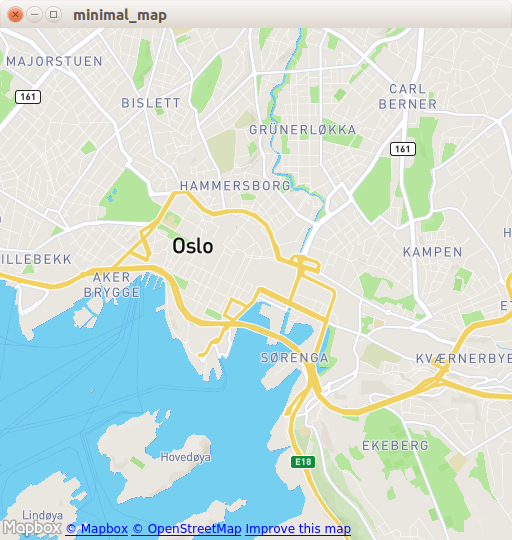
Minimal Map demonstrates how to use the Map item to render a map. It shows the minimum amount of code needed to display the map, and can be used as a basis for further experimentation.
Running the Example
You can run the example from:
- Qt Creator
Open the Welcome mode and select the example from Examples. For more information, see Qt Creator: Tutorial: Build and run.
- Qt Extension for Visual Studio Code
Run the Qt: Open Qt examples command from the Command Palette, and select the example from the list. For more information, see Qt Extension for Visual Studio Code: Tutorial: Build and run.
C++ Code
In main.cpp we use only the QGuiApplication and QQmlApplicationEngine classes.
#include <QGuiApplication>
#include <QQmlApplicationEngine>
In the main function, we first instantiate a QGuiApplication object. Then we create a QQmlApplicationEngine and tell it to load main.qml from the Qt Resource System.
Finally, QGuiApplication::exec() launches the main event loop.
int main(int argc, char *argv[])
{
    QGuiApplication app(argc, argv);

    QQmlApplicationEngine engine;
    engine.load(QUrl(QStringLiteral("qrc:/main.qml")));

    return app.exec();
}
QML Code
In main.qml, we import the QtLocation QML module and its depending QtPositioning QML module. Next, we create the top level window, set a sensible default size, and make it visible. The window will be filled by a Map item showing the map.
import QtQuick
import QtLocation
import QtPositioning

Window {
    width: Qt.platform.os == "android" ? Screen.width : 512
    height: Qt.platform.os == "android" ? Screen.height : 512
    visible: true
    title: map.center + " zoom " + map.zoomLevel.toFixed(3)
           + " min " + map.minimumZoomLevel + " max " + map.maximumZoomLevel

    Plugin {
        id: mapPlugin
        name: "osm"
    }

    Map {
        id: map
        anchors.fill: parent
        plugin: mapPlugin
        center: QtPositioning.coordinate(59.91, 10.75) // Oslo
        zoomLevel: 14
        property geoCoordinate startCentroid

        PinchHandler {
            id: pinch
            target: null
            onActiveChanged: if (active) {
                map.startCentroid = map.toCoordinate(pinch.centroid.position, false)
            }
            onScaleChanged: (delta) => {
                map.zoomLevel += Math.log2(delta)
                map.alignCoordinateToPoint(map.startCentroid, pinch.centroid.position)
            }
            onRotationChanged: (delta) => {
                map.bearing -= delta
                map.alignCoordinateToPoint(map.startCentroid, pinch.centroid.position)
            }
            grabPermissions: PointerHandler.TakeOverForbidden
        }
        WheelHandler {
            id: wheel
            // workaround for QTBUG-87646 / QTBUG-112394 / QTBUG-112432:
            // Magic Mouse pretends to be a trackpad but doesn't work with PinchHandler
            // and we don't yet distinguish mice and trackpads on Wayland either
            acceptedDevices: Qt.platform.pluginName === "cocoa" || Qt.platform.pluginName === "wayland"
                             ? PointerDevice.Mouse | PointerDevice.TouchPad
                             : PointerDevice.Mouse
            rotationScale: 1/120
            property: "zoomLevel"
        }
        DragHandler {
            id: drag
            target: null
            onTranslationChanged: (delta) => map.pan(-delta.x, -delta.y)
        }
        Shortcut {
            enabled: map.zoomLevel < map.maximumZoomLevel
            sequence: StandardKey.ZoomIn
            onActivated: map.zoomLevel = Math.round(map.zoomLevel + 1)
        }
        Shortcut {
            enabled: map.zoomLevel > map.minimumZoomLevel
            sequence: StandardKey.ZoomOut
            onActivated: map.zoomLevel = Math.round(map.zoomLevel - 1)
        }
    }
}
The Plugin item is necessary to define the map provider we are going to use. The example can work with any of the available geo services plugins. However, some plugins may require additional plugin parameters in order to function correctly and we can use PluginParameter to specify them. In this example, we use the osm plugin, which is a Qt Location Open Street Map Plugin and does not require any parameters.
In the Map item, we refer to the plugin we use and we set the center and the zoomLevel of the map.
Requirements
The example requires a working internet connection to download OpenStreetMap map tiles. An optional system proxy should be picked up automatically.
© 2026 The Qt Company Ltd. Documentation contributions included herein are the copyrights of their respective owners. The documentation provided herein is licensed under the terms of the GNU Free Documentation License version 1.3 as published by the Free Software Foundation. Qt and respective logos are trademarks of The Qt Company Ltd. in Finland and/or other countries worldwide. All other trademarks are property of their respective owners.
